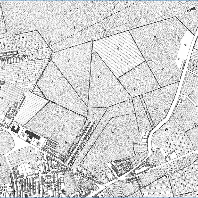
The Mounts in 1847
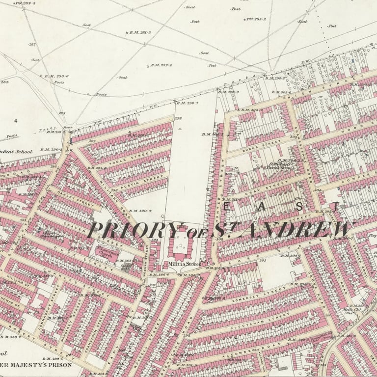
The Mounts in 1883
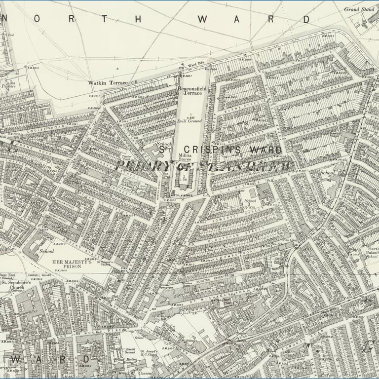
The Mounts in 1899 (Scale @ 25")
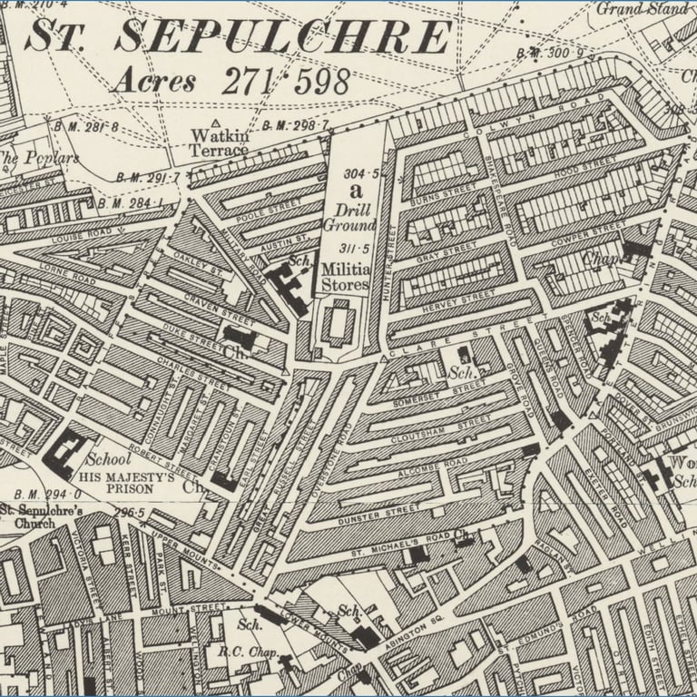
The Mounts in 1899 (Scale @ 6")
Old maps and stories of The Mounts
With thanks to Graham Ward for maps and guidance on their use
When Colwyn Road was called ‘The High Street’
By Mary Pilkington - local history enthusiast with a passion for the history of Northampton
The land where High Street (Colwyn Road) was built was part of the Freehold Land Society’s Kettering Road no.2 estate. Fig 1. The land was purchased in the 1870s but house building really got underway in Colwyn Road in the 1880s. The strange dog leg shape of Colwyn Road stems from an old field boundary formed at the time of the 1778 enclosure awards – Figs 2a & 2b.
There is a tall house which stands out in one part of the street which has the date 1875 on a plaque. It’s called Blake House Fig 3. It still looks isolated in its part of the street on the 1884/5 ordinance survey map Fig 4 of this part of town.
The name High Street was in use by 1881 but in 1885 the name was changed because the owners of houses thought the name High Street was giving the impression that it was a busy business thoroughfare and that this was why they were having trouble renting out property there. They wanted a name which would suggest a more residential atmosphere.
There is coverage of a discussion during a council meeting in the local newspaper dated 11th April 1885 - see photograph of article below Fig 5. Other names were considered as well as Colwyn, and these were Mostyn, Lonsdale and Tavistock. Two of the suggestions were places in Wales and this prompted a weak joke during the meeting that the owners of the houses there must be Welsh. My belief is that these were popular Victorian holiday destinations and that they were suggested to evoke a more restful atmosphere - Colwyn referring to Colwyn Bay and Mostyn which is close to Llandudno. Lord Mostyn did much to promote Llandudno as a destination.
Lonsdale must come from Kirkby Lonsdale, the gateway to the Lake District and another favoured destination of Victorians such as John Ruskin.
Tavistock was another destination for the Victorians; it was considered a gateway to Dartmoor. But that name could also come from Lord John Russell (see also Great Russell Street). Lord John Russell was an important politician and the younger brother of the 7th Duke of Bedford. Russell is their family name. Tavistock is a place with historic links to the Dukes of Bedford and Lord John Russell was the MP for Tavistock. He was a very important figure, being the architect of the Great Reform Act of 1832, which amongst other things lowered the property-based voting qualification. He would have been considered a hero to the founders of the Freehold Land Society.
In any case Colwyn Road was chosen by mid 1885 although the street was known by both names for a time.
Great Russell Street
This was a very early ‘new street’ - late 1830s - and you’ll see it on the Wood and Law map of Northampton 1847 Fig 6. You will also notice empty land marked XP. That meant Extra-Parochial, and no Poor Rate was levied on the houses built there. Great Russell Street is too early to have been anything to do with the Freehold Land Society so would have been built by some local developer(s).
This is an extract from Memories of Northampton circa 1856. Between 1920-21, James Ward (1847-1925), a Northampton nonconformist, social campaigner and journalist wrote a series of six articles for the Northampton Daily Echo describing life growing up in the town in the 1850s and 60s.
With thanks to Graham Ward and Miscellanea Edintone https://edintone.com - a collection of items mostly on nonconformity and Northamptonshire' but with numerous references to The Mounts.
The Mounts in the 1850s
Returning to the town, there were the houses we know as Primrose Hill as far as the old Catholic Cathedral, then gardens to Adelaide-terrace. On the other side the Freehold-street estate was developed by the Freehold Land and Building Society, then under the guidance of the late Alderman Joseph Gurney. I well remember the site of Langham Place being a garden. The Barracks were then occupied by cavalry or artillery, and over the gateway was hung an oil lamp - probably the last public oil lamp used in Northampton.
Turning up St. Lawrence Street, I well remember at the Bailiff Street end walking through growing corn. To the left we walked by fields and gardens to the Racecourse - not one house all the way.
On the Prison side of Bailiff Street was garden ground. From the Bailiff Street entrance to the Racecourse as far as the grandstand there was no promenade and not one house, only fields right through to the Kettering Road. On that main road there was a brickyard and about six houses known as Mount Pleasant, where Brockhall Parade and the chapel stand. No Kingsley Park! On that side of Kettering Road down to where the Primitive Methodist Chapel now stands there was not another building of any kind.